Subject: Southwestern United States
Period: 1862 (circa)
Publication: Illustrated Family Atlas
Color: Hand Color
Size:
23.5 x 17 inches
59.7 x 43.2 cm
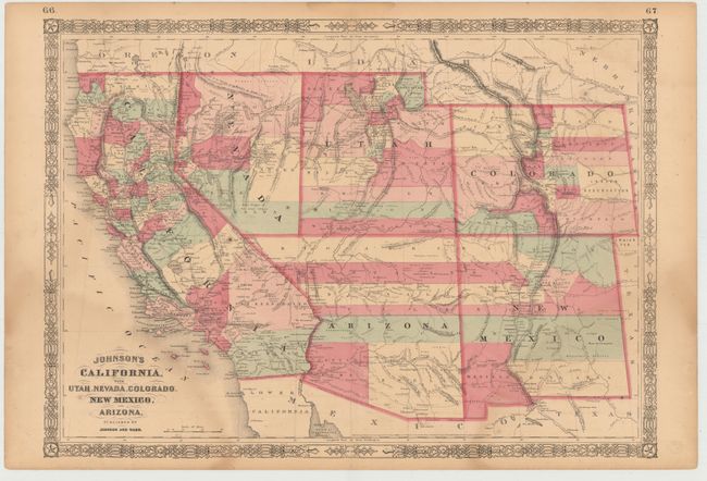
This is an early edition in this great series of maps that Johnson produced with constant updates between 1860 and at least 1867. In this edition Arizona still has the county configurations of the old New Mexico Territory, with the addition of Castle Dome and Ewell counties in the south. The Utah/Nevada border is now at 115° and the southern tip of Nevada, including Las Vegas, is part of Arizona Territory. This map was printed from a completely re-engraved plate with much changed in watershed and mountain detail, and several of the earlier notations removed. Details the U.S. Mail routes, the Emigrant road to California, the proposed railroad route through Utah, Nevada and California. The route of the short-lived Pony Express is delineated and named.
References:
Condition: B
There are faint damp stains at lower left and right with light toning, scattered foxing, and short centerfold separations closed on verso with archival tape. There are a few edge tears in blank margins that have been closed on verso with archival tape.