Subject: California, Nevada
Period: 1863 (dated)
Publication:
Color: Hand Color
Size:
21.5 x 26.3 inches
54.6 x 66.8 cm
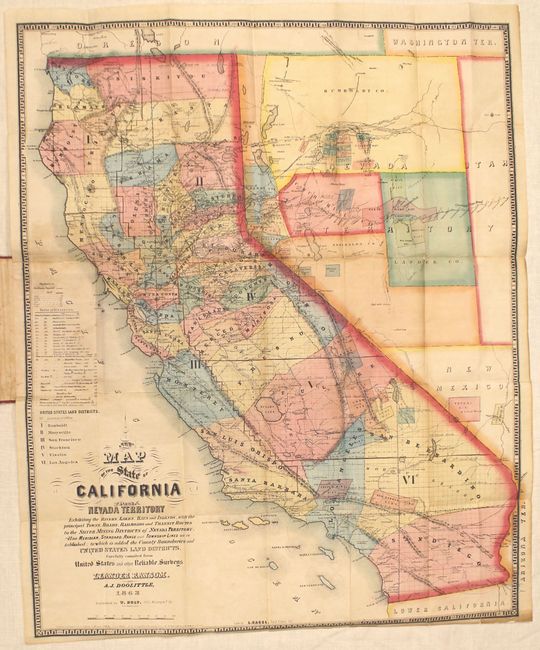
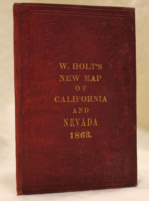
This rare pocket map of California and Nevada Territory is an updated version of a map issued a few short months earlier by the same authors (also copied by A.L. Reed). It depicts the important mining districts that sprung up in the area along with the roads leading to them. The Reese River district shows the towns of Austin, Clifton and Jacobsville, and there are the new districts of Smoky Valley and Big Canyon to the south and Mt. Hope to the north. The acceleration of mining activity and resultant economic boom was a key factor is Nevada’s early statehood (well ahead of its neighbors Utah, New Mexico and Washington Territory). The map shows six land districts in California, delineates counties, and shows the Overland Stage Road with thirteen stations named east of Austin, Nevada (another indicator of Nevada’s growth). Utah is shown appropriately with a western border along the 115th meridian and Washington Territory is still named despite Idaho Territory being created early in that same year. Includes 4 pp. of text showing tables of routes and distances. Folds into stiff red cloth covered boards with gilt title on front cover.
References: Wheat (TMW) #1071.
Condition: B+
Issued folding with several short splits at fold intersections that have all been archivally repaired, a 3" professionally repaired tear from Sonoma to Sutter county, and minor toning where the map folds into the boards. The covers are lightly worn and stained.