Subject: Canada
Period: 1783 (dated)
Publication: Atlas Moderne…
Color: Hand Color
Size:
17.1 x 11.8 inches
43.4 x 30 cm
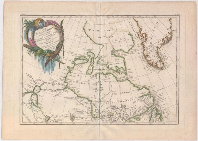
Third state of this lovely map that covers eastern Canada and Greenland from the bottom of Hudson Bay, northward beyond the Arctic Circle to about 70° N. latitude. It includes an interesting depiction of a passage between Lake Winnipeg and Hudson Bay alluding to a possible navigable passage to the Pacific. The sheet is decorated with a large title cartouche. This is the top sheet of a two-part map; thus it does not cover the whole region indicated in the title. The map has full borders and stands on its own without the other sheet.
References: Kershaw #475; McCorkle #771.2.
Condition: B+
A nice impression with a few spots of foxing and some minor archival repairs along centerfold towards bottom.