Subject: Tasmania, Australia
Period: 1845 (circa)
Publication: National Atlas
Color: Printed Color
Size:
19.8 x 24 inches
50.3 x 61 cm
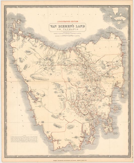
This is the most highly detailed map we have seen since Tasmania was normally shown as an inset on other maps of Australia from the period, with the exception of the smaller Tallis map. Very fine detail with the map engraved and colored to show the divisions, namely Kent, Buckingham, Devon, Dorset, Cornwall, Glamorga, Cumberland, Monmouth, etc. A large unsettled region is unnamed in the west. This area will eventually be organized as Wellington, Russell, Lincoln, Montagu, Franklin, Montgomery and Arthur. Locates the towns of Hobart, George Town, Oatlands, Richmond and Bothwell Grantham. Includes scores of small villages and settlements, all connected by a network of wagon roads. The core of settlement is limited to the central portions. The Penal Colony in Port Arthur is not noted. This map is circa 1845 which was the same year the Hobart Savings Bank opened for business. The scale of 10 miles per inch provides remarkable detail of the topography, watershed and coastline. From Johnston’s early lithographed edition of his National Atlas.
References: cf. Tooley (Australia) #780.
Condition: A
Light toning along the edges of the sheet, a few minor spots, and a centerfold separation that just enters border at right and has been closed on verso with archival tape.