Subject: St. Petersburg, Russia
Period: 1738 (circa)
Publication: Lo Stato Presente...
Color: Hand Color
Size:
7.3 x 6.4 inches
18.5 x 16.3 cm
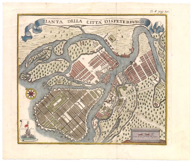
A handsome bird's-eye plan of the city of St. Petersburg, centered on Petrogradsky Island and the Peter and Paul Fortress. The rectangular grid on Vasilyevsky Island shows Peter the Great's original intention of creating a network of intersecting canals and streets similar to Venice or Amsterdam. Kronstadt, the city's main seaport, is shown in a small scroll cartouche at bottom left. A banner-style title cartouche adorns the top of the plan. This map appeared in an Italian edition of Thomas Salmon's multi-volume Modern History, which was published in up to 31 volumes starting in 1724, with several editions in English, Dutch, German and Italian through 1782. This map was copied from the Dutch language version, which is attributed to Isaac Tirion.
References: cf. Shirley (BL Atlases) G.SALM-1a.
Condition: A
Issued folding, now pressed, with Japanese tissue reinforcing folds on verso.