Catalog Archive
Auction 145, Lot 512

"Carte Nouvelle du Royaume de France Divise en toutes ses Provinces et ses Acquistions...", Ottens, Reiner and Joshua
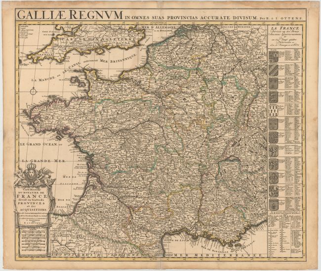
Subject: France

Period: 1730 (circa)

Publication:

Color: Hand Color

Size:
23.3 x 19.1 inches
59.2 x 48.5 cm
Download High Resolution Image
(or just click on image to launch the Zoom viewer)

A handsome map of France showing the country divided into provinces. The map is boldly engraved with good detail throughout. The title cartouche incorporates the royal coat of arms and several distance scales. A panel at right displays the twelve coats of arms of the ancient governments, and includes the subdivided regions within each. An alternate Latin title, "Galliae Regnum in Omnes suas Provincias Accurate Divisum", can be found in the upper margin. This map was originally published by Pieter Husson in 1708.

References:

Condition: B+

Original color with a few light stains and an archivally repaired centerfold separation that enters 2" into map at bottom.

Estimate: $150 - $190

Unsold

Closed on 6/12/2013

Archived