Subject: Eastern Wales
Period: 1676 (published)
Publication: Theatre of the Empire of Great Britain…
Color: Hand Color
Size:
20 x 15 inches
50.8 x 38.1 cm
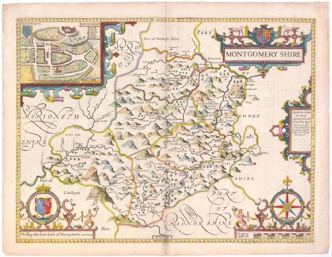
A handsome map of the historic county of Montgomery in Wales, based on the work of Christopher Saxton. The map is elaborately decorated with five strapwork cartouches, including a title cartouche, publisher's imprint, distance scale, and dedication to Philip Herbert, First Earl of Montgomery. The final cartouche features an inset with a bird's-eye plan of the city of Montgomery, with a lettered key identifying several key locations. Published by Thomas Bassett and Richard Chiswell.
References: Shirley (BL Atlases) T.SPE-1j.
Condition: B+
Watermarked paper with light soiling along centerfold and a professionally repaired centerfold separation in bottom blank margin.