Catalog Archive
Auction 145, Lot 310

"Birdseye View of Puget Sound Country and Vicinity Compiled Expressly for Puget Sound Navigation Company",
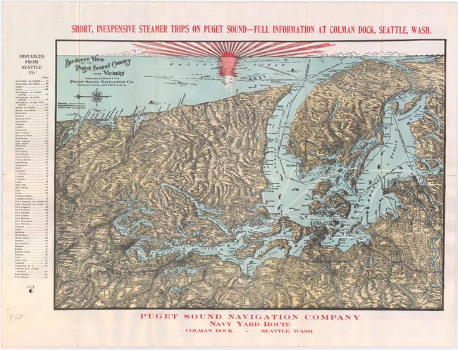
Subject: Washington

Period: 1910 (circa)

Publication:

Color: Printed Color

Size:
19.8 x 13.6 inches
50.3 x 34.5 cm
Download High Resolution Image
(or just click on image to launch the Zoom viewer)

This very attractive map was produced for the Puget Sound Navigation Company and was distributed to the ferry lines' passengers. The map shows railroads, auto roads and electrical lines. A list of 69 towns with their distances from Seattle is along the left border. On verso is a romantic narrative describing the "Beauties and Wonders of Puget Sound", complete with nearly a dozen picturesque black and white photographs of the natural settings within the Sound. Map folds into colorful decorative self-wrappers depicting bathers on the beach with snow-capped mountains in the background.

References:

Condition: A

Clean and bright.

Estimate: $200 - $250

Sold for: $300

Closed on 6/12/2013

Archived