Subject: Gettysburg, Pennsylvania, Civil War
Period: 1910 (dated)
Publication:
Color: Hand Color
Size:
20 x 26.7 inches
50.8 x 67.8 cm
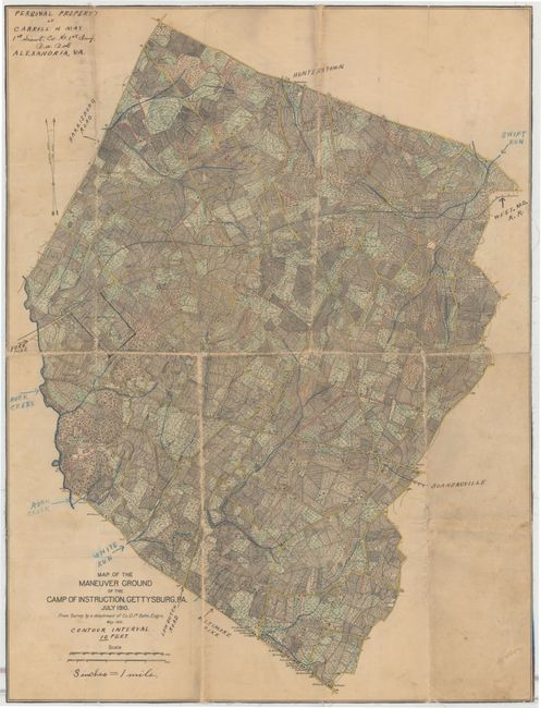
This is a reduced version of a manuscript map produced by the War Department showing the instruction grounds at Gettysburg. The battlefield and surrounding area was used for a variety of military purposes after the Civil War including training exercises and re-enactments. In the early 20th century, the camp had over 10,000 regular staff members stationed there. The map itself shows land holdings with property owners named, roads, railroads and rivers. Topography is indicated by contour lines at ten foot intervals. Based upon the survey by a detachment of Co. D. 1st Battalion Engineers. The previous owner's signature, Carroll H. May of Alexandria, VA, appears in the top left blank margin.
References:
Condition: C+
Backed in linen to reinforce and repair numerous small fold separations. There are a few small holes at fold intersections and abrasions along several folds. Soiled with several ink notations from a previous owner, indicating this example was used in the field.