Catalog Archive
Auction 145, Lot 285

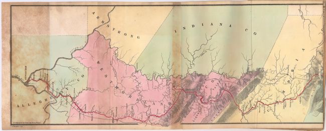
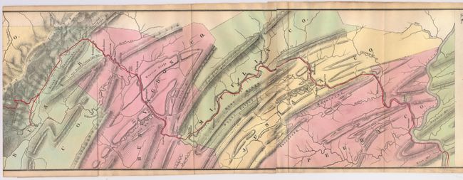
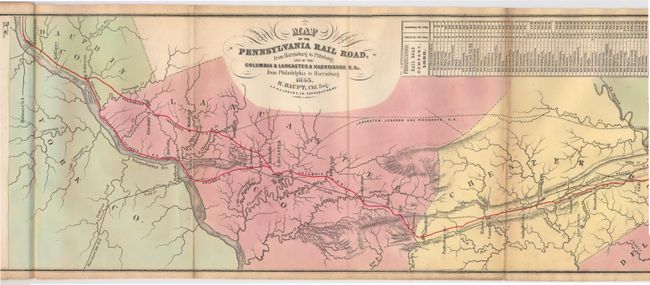
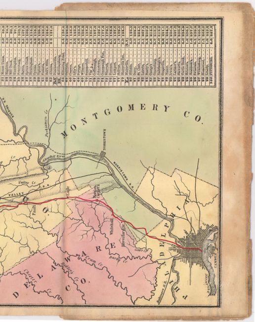
"Map of the Pennsylvania Rail Road, from Harrisburg to Pittsburg; and of the Columbia & Lancaster & Harrisburg R.Rs. from Philadelphia to Harrisburg",

Subject: Pennsylvania, Railroads

Period: 1855 (dated)

Publication:

Color: Hand Color

Size:
70 x 8.2 inches
177.8 x 20.8 cm
Download High Resolution Image
(or just click on image to launch the Zoom viewer)

This long and uncommon strip map of the Pennsylvania Railroad was one of the first maps to show the entire line from Philadelphia to Pittsburgh. It was reached in 1852 using the Portage Railroad, and in 1854 using the Horseshoe Curve and the Gallitzin Tunnel. The map was published by P. S. Duval & Co's Steam Lith. Press, Philadelphia in "Guide for the Pennsylvania Railroad with an Extensive Map; including the Entire Route, with All Its Windings, Objects of Interest, and Information Useful to the Traveler." The Pennsylvania Railroad grew to be the largest railroad in the United States.

References: Modelski #517.

Condition: B+

Issued folding with light toning and staining along the folds.

Estimate: $250 - $325

Sold for: $150

Closed on 6/12/2013

Archived