Subject: San Clemente Island, California
Period: 1856 (dated)
Publication:
Color: Hand Color
Size:
16.7 x 12 inches
42.4 x 30.5 cm
The Office of Coast Survey is the oldest U.S. scientific organization, dating from 1807 when Congress directed that a "survey of the coast" be carried out. By 1836, it was called the U.S. Coast Survey and in 1878, the name was changed to the U.S. Coast and Geodetic Survey. Today the Office of Coast Survey is a division of the National Oceanic and Atmospheric Administration NOAA.
The survey teams, composed of civilians as well as Army and Naval officers, charted the nation's waterways and produced a wide array of reports, survey charts, hydrographic studies of tides and currents, astronomical studies and observations, and coastal pilots. These charts are an important record of the changing nature of the nation's coastlines. In additional to coastal charts, the U.S. Coast and Geodetic Survey produced land sketches, Civil War battle maps, and the early aeronautical charts.
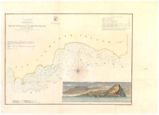
This chart details the coastline, bottom type and soundings of San Clemente Island. The large inset is a sea view of the island with a sailing ship anchored offshore. Issued by the Hydrographic Party under the command of Lieut. James Alden, USN.
References:
Condition: B+
Issued folding and now flattened with a binding trim at lower left replaced with old paper, several minor abrasions along the folds, and one small hole at a fold intersection repaired on verso with archival material.