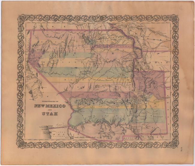
Subject: Southwestern United States
Period: 1855 (dated)
Publication: Atlas of the World
Color: Hand Color
Size:
15.4 x 12.6 inches
39.1 x 32 cm
The uncommon First State of this iconic map of the American Southwest, is distinguished by the lack of Colton’s name in the title or beneath the title. It depicts the new territories of Utah and New Mexico, which were created in 1854. Utah Territory encompasses all of today's Nevada and extends west to the Continental Divide into present-day Colorado with Fillmore City as it's capital. Nebraska and Kanzas territories bound Utah on the east. New Mexico Territory includes part of southern Colorado and stretches west to include Arizona and the southern tip of present-day Nevada. The map was compiled from information garnered by John Charles Fremont in the 1840s, Howard Stansbury in 1850 and the Pacific Railroad surveys of 1853-54. Fremont's routes, proposed routes for the Pacific Railroad, the Cimarron Trail, the Oregon Route of 1843, the Spanish Trail and several other wagon roads are all traced. Wheat found this interesting map important enough to use as the frontispiece to Volume 4 of his Mapping the Transmississippi West. It is one of the rarest and most desirable of all Colton atlas maps, dated and published in 1855.
References: Wheat [TMW] #832; Brown (Portolan - Spring 2005) pp. 48-51.
Condition: B
Toned with faint damp stain at upper right. A short edge tear was repaired with archival tape, well away from the map.