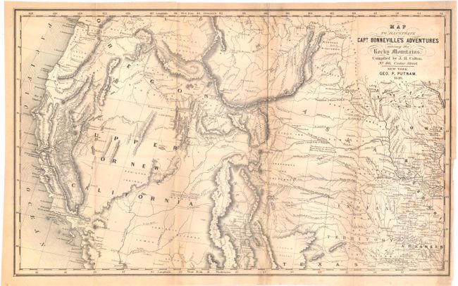
Subject: Western United States
Period: 1849 (dated)
Publication: Irving's Adventures of Captain Bonneville
Color: Black & White
Size:
18.6 x 11.6 inches
47.2 x 29.5 cm
This interesting map is based on Fremont's map. The region west of the Mississippi to the Pacific Ocean is delineated with the rivers and towns of the gold region in California well shown. The expedition route described is that of Captain Benjamin Bonneville who explored the American West from 1832-1836. The expedition party traveled parallel to the course of the Snake and the Columbia Rivers, going as far as Fort Walla Walla before turning back. Fremont's route through California is shown, as well as Kearny's route along the Gila River and the Emigrant route. Published by J.H. Colton, No. 172, William Street, New York. Printed on fine banknote quality paper.
References: Wagner-Camp #67:14.
Condition: B
Issued folding with some light toning, a few small stains, and a tiny pinhole in the bottom left neatline. There is a binding trim at bottom right and an associated 1/2" binding tear that has been closed on verso with archival tape.