Subject: Eastern United States, Civil War
Period: 1864 (dated)
Publication:
Color: Hand Color
Size:
35.6 x 25 inches
90.4 x 63.5 cm
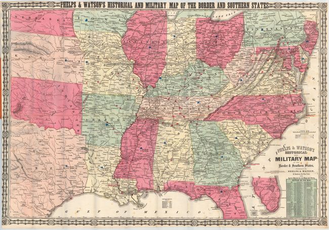
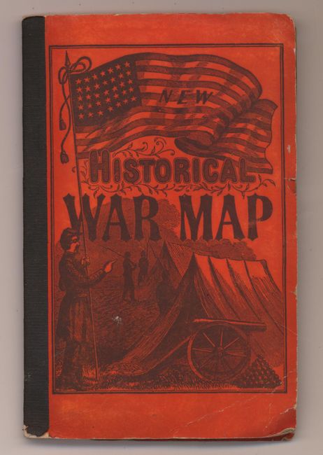
This important Civil War map focuses on the Confederate states including Texas, and the bordering states from Nebraska to Pennsylvania. Good detail throughout including towns, railroads, forts, and distances from place to place along the railroads. It presents the war's battles marked throughout with red colored dots. Blue dots mark the population statistics for each state and in the southern states free and slave populations are noted. At lower right is an extensive list of "Battles of the War." The last battle listed is the Battle of Spotsylvania Court House May 4 - 12 [1864]. The map extends north into Lake Erie and west to include most of Texas, Indian Territory, Kansas, and Nebraska. In Florida the map ends in the vicinity of Bayport and Mellon with an inset on the same scale completing the state to Key West and Dry Tortugas. Copyright 1862, the map was regularly updated during and after the war, this being a Civil War Edition. The railroads are well delineated but are not named. Surrounded by decorative border with corner graphic elements. Folds into orange pictorial covers featuring an army camp with a large U.S. Flag above. Inside the 35-page booklet is "Brief Description of Battles and Skirmishes of the War" that lists the battles in chronological order.
References:
Condition: B+
Issued folding with scattered foxing. Covers are lightly worn.