Subject: Eastern United States & Canada, Texas
Period: 1845 (published)
Publication: Travels in North America; with Geological Observations…
Color: Hand Color
Size:
19.6 x 15.1 inches
49.8 x 38.4 cm
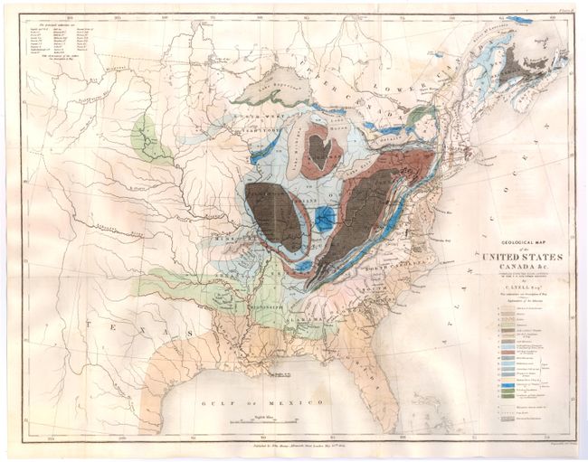
This is an important and early geological map by Sir Charles Lyell. Color-coded key identifies 20 different geological units. The map extends to about the 110th meridian to include the Republic of Texas, Arkansas, Missouri and the North West Territory. Lyell had two major and controversial goals in publishing his work and this map: first, he endeavored to establish a strict uniformitarian theory of the earth's geology, and also to standardize the terminology and methodology employed in the science of geology. His map, along with James Hall's work of 1843, is a landmark improvement in geological representations and mapping.
References: Marcou & Marcou #34.
Condition: B
Issued folding, now pressed, on paper with "J. Whatman 1845" watermark. There is light offsetting, a few stains, and several fold separations that have been archivally repaired on verso. A tear that extends 2" into image at top has also been professionally repaired. Trimmed almost to neatline at right.