Subject: Colonial United States & Canada
Period: 1760 (published)
Publication: Gentleman's Magazine
Color: Black & White
Size:
8.8 x 7 inches
22.4 x 17.8 cm
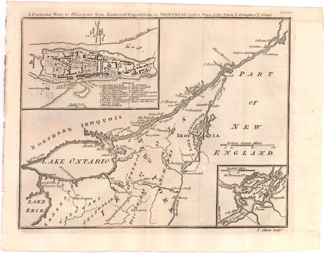
After the fall of Quebec, Montreal was the sole remaining French power center in Canada. The British General, Jeffery Amherst, occupied Fort Ticonderoga and Crown Point in the fall of 1759. He began a three-pronged offensive converging on Montreal the following spring. When Vaudreuil de Cavagnal surrendered on September 8, 1760, this ended the last major campaign of the French and Indian War. This map shows the St. Lawrence River from Quebec City to the Great Falls of Niagara 140 ft and east to include the Hudson River, Albany and Lake Champlain. Details include several forts, Drowned Lands, and Indian tribes. An inset at lower right shows the environs of Montreal Island. At upper left, a plan of the walled city of Montreal portrays individual buildings and has an index of 16 important features including the Arsenal, hospital, the Governor's Palace, and the gardens of Mons Beausou and de Quain.
References: Jolly #GENT-145.
Condition: B+
Issued folding with a couple of minor spots. A slightly uneven impression at bottom right.