Subject: Colonial North America
Period: 1743 (dated)
Publication: Charlevoix's Histoire et Description Generale de la Nouvelle France
Color: Black & White
Size:
14 x 11 inches
35.6 x 27.9 cm
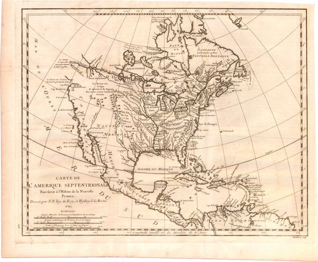
This interesting map was compiled from manuscripts brought back to France by Pierre Francois Xavier de Charlevoix, a Jesuit who explored the French colonies in North America in the early part of the eighteenth century. The most distinctive feature of the map is the Fleuve de l'Ouest (River of the West) shown as a definitive waterway flowing west from Lake Superior to the Pacific Ocean near the Montagne de Pierres Brillantes (mountain of brilliant stones). The actual northwest coastline is indistinct with notations of the discoveries of Martin d'Aguilar. The Missouri, Rio Grande (Rio du Nord), Colorado rivers all originate near each other beneath a notation to the effect that reports on kingdoms of Quivira and Taguiao are uncertain. The Mississippi River system and the Great Lakes reflect Charlevoix's travels in the region and reports he compiled from fur traders.
References: Tooley (MCC-96) #692; Wagner (NW) #544; Wheat (TMW) #120; McGuirk #13.
Condition: B+
Issued folding on watermarked paper with light offsetting.