Subject: South Pacific Ocean & Australia
Period: 1861 (dated)
Publication:
Color: Hand Color
Size:
25.5 x 20.2 inches
64.8 x 51.3 cm
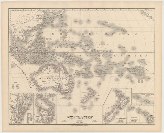
This highly detailed chart of the south Pacific Ocean features Australia and New Zealand and is filled with information on islands, harbors, and the topography of the land. The chart extends north to include China, Japan and even a bit of California. Five inset charts are included: The southeast coast of Australia, Tasmania (Van Diemen's Land), New Zealand's North and South Islands, Tahiti Archipelago, and Hawaii Archipelago. A colored legend below the title identifies the various possessions of the British, Dutch, French, Spanish, Portuguese, and Americans. The fine attention to detail on this map is typical of the excellence of the work of the German engravers of the 19th century. Drawn by Carl Graf (1822-c.1897).
References:
Condition: A
Original outline color on heavy paper with some tiny, insignificant spots and light toning along sheet edges.