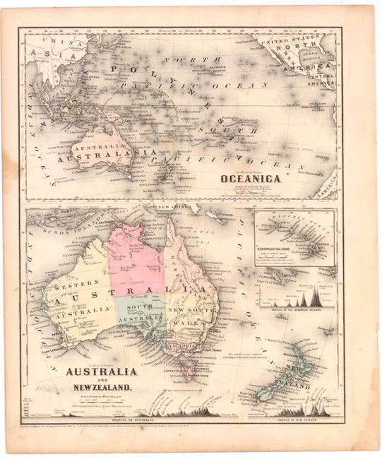
Subject: Pacific Ocean & Australia
Period: 1860 (dated)
Publication: Colton's School Atlas
Color: Hand Color
Size:
9.8 x 12 inches
24.9 x 30.5 cm
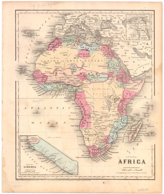
Two maps on one sheet depicting Australia and New Zealand with an inset chart of the Sandwich Islands (Hawaii). Australia is divided into five provinces with minimal interior detail. The chart includes comparative profile views of the mountains in Australia, New Zealand, and Hawaii. The upper map, titled Oceanica, depicts the entire Pacific Ocean extending from China, Japan and the United States in the north to Australia, New Zealand, and the southern tip of South America in the south. There is great detail of all the islands in the North and South Pacific. On the verso is a handsome map of Africa with an inset of Liberia.
References: cf Tooley (Australia) p. 44, #313.
Condition: B
Light foxing and soiling with two damp stains in blank margins, one of which enters map border at left.