Catalog Archive
Auction 144, Lot 261

"[Lot of 2] Coste Occidentale d'Afrique, depuis le Detroit de Gibraltar... [and] Carte de la Coste Occidentale d'Afrique, depuis le XIIe. Degre de Latitude Septentrionale...", Bellin, Jacques Nicolas

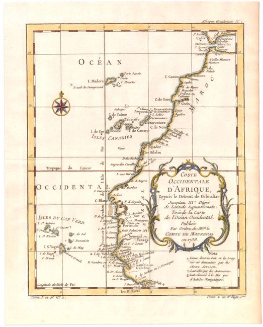
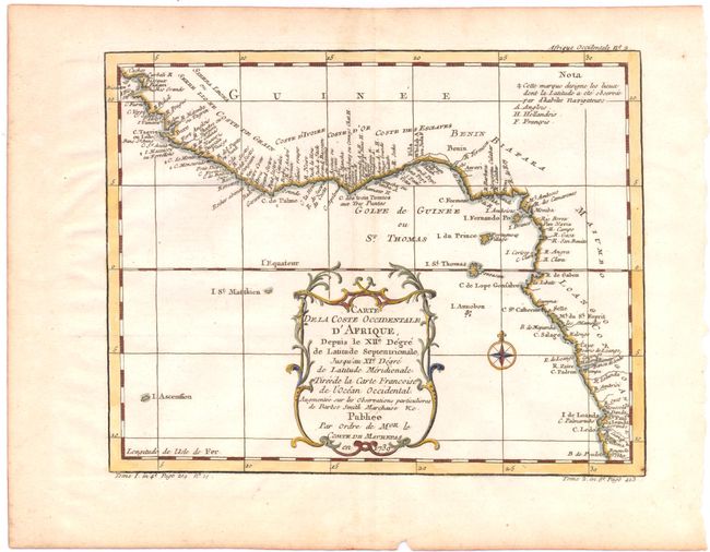
Subject: Western Africa

Period: 1738-39 (dated)

Publication:

Color: Hand Color

Size:
7.9 x 9.9 inches
20.1 x 25.1 cm
Download High Resolution Image
(or just click on image to launch the Zoom viewer)

Handsome lot of two depicting Africa's west coast from Morocco to Angola, locating many harbors and capes. The first map shows the northwestern coast starting at the Strait of Gibraltar and continuing through Senegal, with the Cape Verde and Canary Islands included offshore. The second map covers the Grain, Ivory, Gold, and Slave coasts and extends south to Angola. Both maps are embellished with a colorful compass rose and decorative title cartouche featuring leaf and scroll motifs.

References:

Condition: B+

Watermarked paper with some faint toning along centerfold and a few minor spots.

Estimate: $150 - $190

Sold for: $75

Closed on 4/3/2013

Archived