Subject: India
Period: 1835 (dated)
Publication:
Color: Hand Color
Size:
12.2 x 15.5 inches
31 x 39.4 cm
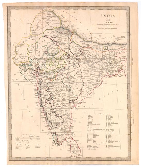
The beginning of the nineteenth century saw a period of rapid market growth and innovation in the map publishing world. Increased literacy and public interest in new frontiers and colonies overwhelmed the market because it was oriented toward the small, affluent market of the previous century. With the intent to fill this void, The Society for the Diffusion of Useful Knowledge (SDUK) was founded in 1828 in London, by Lord Brougham and a group of men dedicated to the education of the aspiring working class and the Utilitarian ideal of 'Knowledge is Power.' The society produced an array of education materials, but the series of maps was one of their most successful ventures. A number of engravers and printers were used to produce the maps, which eventually exceed 200 sheets, and continued to be published after the Society as a whole ceased to function.
A very detailed map of India that delineates British possessions, states under British protection, and independent states, and additionally shows French, Portuguese, and Danish territories. The map locates all primary cities, towns, harbors, rivers and coastal plains, and includes the island of Ceylon (Sri Lanka). Engraved by J. & C. Walker, and published in London by Chapman & Hall.
References:
Condition: B+
Original color with light soiling and one small hole in top neatline.