Subject: Southeast Asia
Period: 1872 (dated)
Publication:
Color: Black & White
Size:
49.2 x 40.1 inches
125 x 101.9 cm
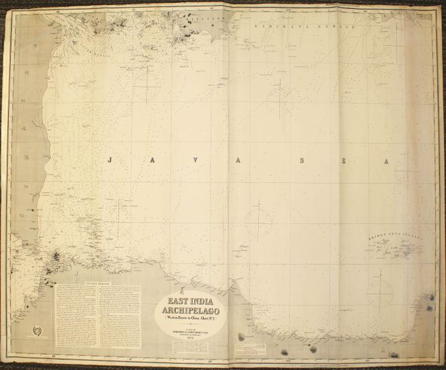
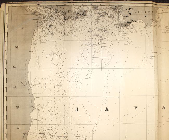
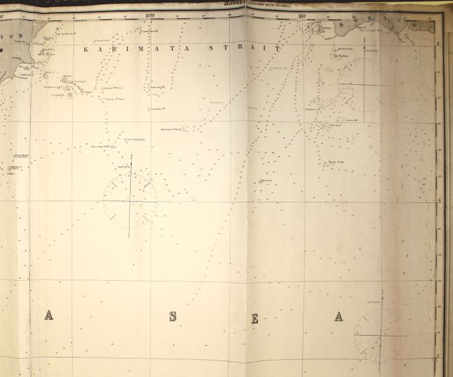
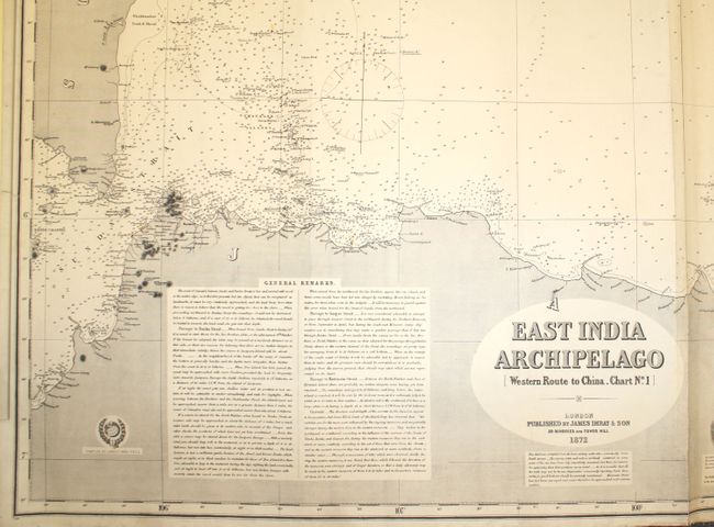
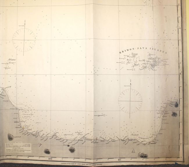
An impressive blue-backed chart on two joined sheets showing the Java Sea and the adjacent islands of Sumatra, Java, Bangka, Belitung (Billiton) and Borneo. This detailed chart includes hundreds of soundings, reefs, anchorages, rocks, and shoals. There are extensive navigational notes regarding currents and passage through Banka Strait, Gaspar Strait, and Karimata Strait. There is also good information along the coasts of towns, forts, capes, points, rivers, and mountain peaks. Lighthouses are marked with red and yellow, as is typical on Imray charts. This is one of the largest and most comprehensive charts of the Java Sea designed for navigation in the late 19th century. The chart was one of six charts showing the western route to China published by James Imray & Sons, in London. On verso is a paper label stating: "Western Route to China. Chart No. 1" with a marked price of 7s.
References:
Condition: B
In very nice condition for a chart this size. There is minor soiling and light toning at far right and a few small abrasions to the right of the title. A tear that extends 11" across the top left corner has been professionally repaired. There are a few tiny tears in blank margins and two that just enter map border.