Catalog Archive
Auction 144, Lot 207

"Carte Moderne de la Majeure Partie de la Turquie d'Asie; avec les Pays Circonvoisins", Bonne, Rigobert

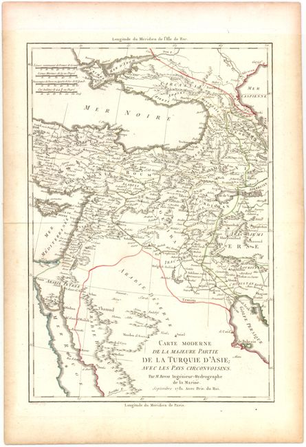
Subject: Middle East

Period: 1781 (dated)

Publication: Atlas Portatif

Color: Hand Color

Size:
8.7 x 12.7 inches
22.1 x 32.3 cm
Download High Resolution Image
(or just click on image to launch the Zoom viewer)

The focus of this detailed map is on eastern Turkey and the Middle East, surrounded by the Black Sea, the Caspian Sea, the Mediterranean, the Red Sea, and the Persian Gulf. The map depicts the regions and boundaries of the area as they were known to 18th century cartographers. Published in Abbe Grenet's Atlas Portatif.

References:

Condition: A

Watermarked paper with some toning along edges.

Estimate: $100 - $140

Sold for: $75

Closed on 4/3/2013

Archived