Subject: Northern Europe, North Sea
Period: 1797-1801 (circa)
Publication: Naval Gazetteer
Color:
Size:
7 x 9 inches
17.8 x 22.9 cm
These two map of the North Sea are from American editions of Malham's The Naval Gazetteer; or, Seaman's Complete Guide, first published in London in 1795.
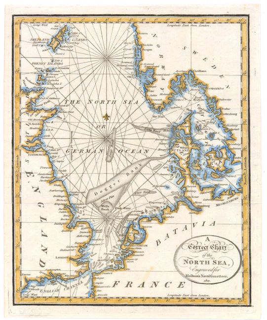
A. A Correct Chart of the North Sea, dated 1801, hand color (7 x 9"). This attractive chart shows the North Sea from Norway and the Shetland Islands down to the English Channel, and extends east to include the Kattegat. Principal towns and harbors are noted along the coasts, and banks, reefs, and rocks are marked in the sea. Condition: Issued folding with minor soiling.
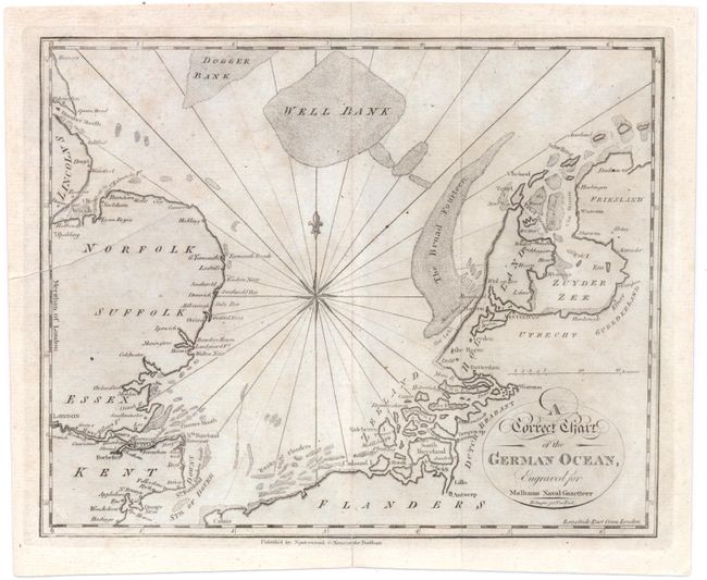
B. A Correct Chart of the German Ocean, circa 1797, black & white (9.1 x 7.4"). This chart shows the southern portion of the North Sea, from the Strait of Dover to Lincolnshire, England and the northern reaches of the Netherlands. Principal harbors are shown along the coasts, and banks are clearly noted. A compass rose and fleur-de-lys at the center of the map complete the composition. Condition: Issued folding with a printer's crease at left, light foxing, and short centerfold separations in blank margins.
References: McCorkle (Maps in 18th Century Geography Books) #253, Vol. II, #4 & 6.
Condition: B+
See descriptions above.