Subject: Jamaica
Period: 1758-1851 (circa)
Publication:
Color: Hand Color
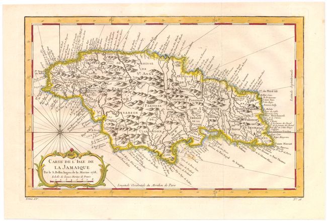
A. Carte de l'Isle de la Jamaique, by Jacques Nicolas Bellin, from Histoire Generale des Voyages, dated 1758 (12.5 x 8.2"). Strongly engraved map describes this island of the Greater Antilles. Divided by parishes, the map shows remarkable detail with scores of place names along the coast plus mountains, personal estates, watershed and other details in the interior. At lower left is a decorative rococo-style title cartouche with compass rose and rhumb lines above. Reference: Kapp (MCC-42) #77; Sellers and Van Ee #1917. Condition: Issued folding with a couple of small spots, faint offsetting, and one small hole in the right neatline that has been professionally infilled. (B+)
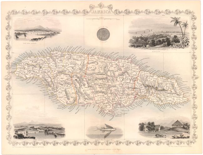
B. Jamaica, by John Tallis, circa 1851 (13.5 x 10.2"). This attractive chart of the island includes good detail with the names of many villages and coastal features. The island is sectioned into about 20 Administrative Divisions. The divisions of St. Dorothy, St. John, St. Thomas, Port Royal, and St. Davids have been absorbed by the 14 divisions we see today. The map features decorative borders, and five large and nicely rendered vignettes, which includes Port Royal Harbour, Kingston, Port Antonio, Sugar Mill, and a flying fish. Condition: Original color with minor soiling confined to the blank margins. (A)
References:
Condition:
See description above.