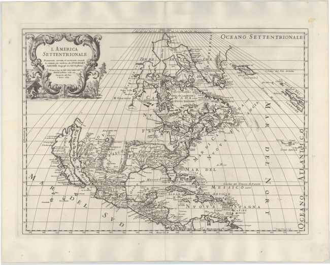
Subject: North America
Period: 1687 (dated)
Publication:
Color: Black & White
Size:
21.5 x 15.5 inches
54.6 x 39.4 cm
This is the updated second state of Rossi's fine map of North America, based on the seminal Sanson map of the region. As in the Sanson version, California is shown as an island on the Foxe model with two northern bays, and all five Great Lakes are shown, albeit with Superior and Michigan shown open-ended. There are many place names noted on California's coast, including Pta de Monte Rey, Canal de S. Barbara, P. de S. Diego, and Catalina Island is named I. de S. Catalina. Several Indian tribes are identified in New Mexico where the R. del Norte (Rio Grande) mistakenly flows from an interior lake near Taos (Taosji) and empties into the Mar Vermeio o Mer Rosso (Gulf of California). The political divisions favor the French point of view, with Canada and Nuova Francia covering much of the eastern half of the continent. The Arctic cartography is typical for the period, with a large, triple island in Baffin Bay, and Greenland shown on Sanson's three-island model.
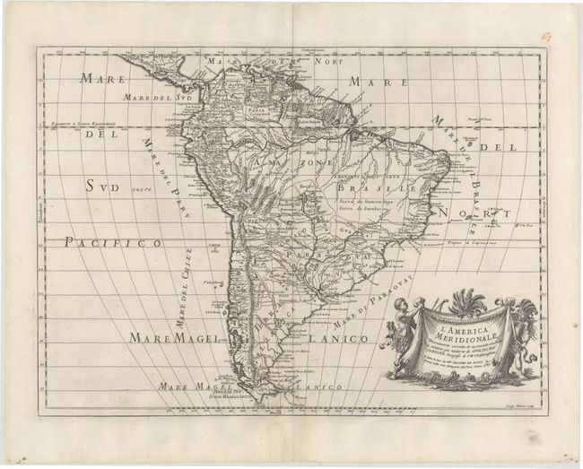
Rossi's matching map of South America is also being offered in lot 325, and would make for an attractive pairing.
References: Burden #491; McLaughlin #65.
Condition: A
Strong impression on watermarked paper with a few tiny spots. There is a centerfold separation in top blank margin and a short tear adjacent to centerfold just north of the Great Lakes that have both been professionally repaired.