Subject: Western Hemisphere
Period: 1614 (published)
Publication: Cosmographey
Color: Hand Color
Size:
14.3 x 12.2 inches
36.3 x 31 cm
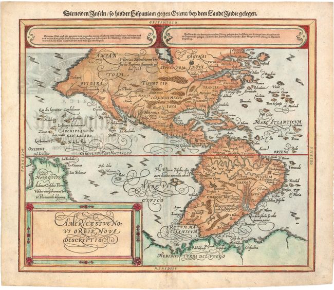
This woodcut map of the Americas is based on Abraham Ortelius' classic map of 1570. Its distinguishing features include the huge bulge in the southwest coastline of South America, the extensive western coastline of North America, and the great southern continent, here called Meridies Terra de Fuego. Because of the restrictions inherent in wood block engraving, Petri's map is somewhat more generalized. A village of Quivira and the Sierra Nevada are located in present-day California. Inland is the kingdom of Quivira with those of Anian and Tolm to the north and east. Above the map are two elongated ovals of gothic German text and above that, in the upper margin a German title, "Die newen Inseln so hinder Hispaniam Gegen Orient bey dem Landt Indie Gelegen," is above the map. On verso is an additional similar German title.
References: Burden #67.
Condition: B+
A nice impression with some show-through of text on verso and professional repairs along centerfold with a tiny amount of image expertly replaced in facsimile.