Subject: Exploration and Surveys
Period: 1848 (published)
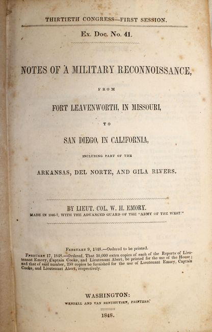
Publication: House Ex No. 41, 30th Cong., 1st Sess.
Color: Black & White
Size:
6 x 9 inches
15.2 x 22.9 cm
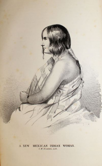
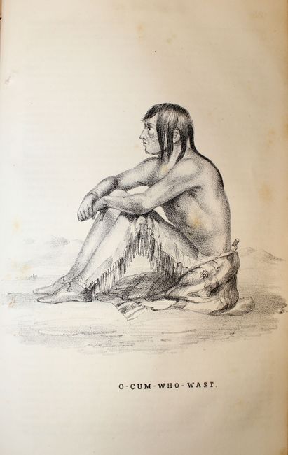
This is the House edition of Emory's important report documenting the 1846-1847 journey of the advanced guard of General Kearny's Army of The West. Emory was Brevet Major of the Corps of Topographical Engineers. This report features full-page lithographs of the natives, rivers, landscapes, towns and pueblos, flora and fauna that were encountered during the march to the Pacific. Emory's reports are enjoyable reads with passages such as "I stopped in the little town of Isoletta, to visit my friend, the alcalde, who has the reputation, Indian though he be, of being the most honest man and best maker of brandy in the territory."
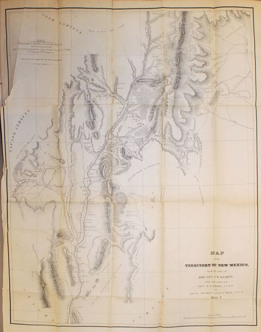
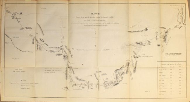
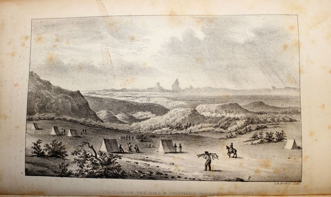
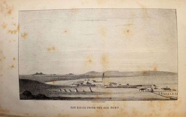
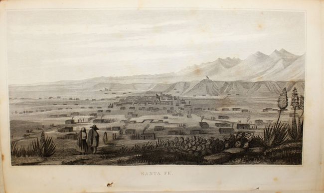
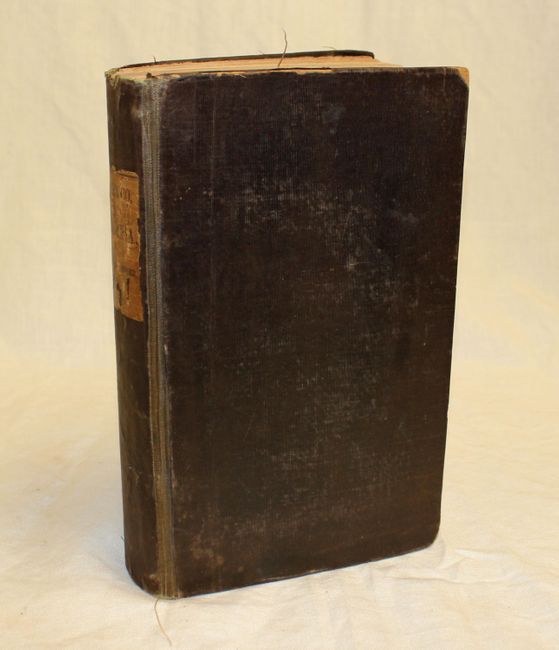
This expanded edition contains Emory's report plus the reports of Lt. Abert, Col. Cooke and Capt. Johnston. Together these reports summarize the activity of the U.S. Army of the West after the capture of New Mexico with important early views of the region. It is illustrated with 64 lithographed plates (40 Emory + 24 Abert), 3 battle plans and 2 folding maps. The maps are both important contributions to western cartography. The first map,Map of the Territory of New Mexico (25.5 x 19.5") was compiled by Lieutenants Abert and Peck after the conquest of New Mexico. The second, Sketch of Part of the March and Wagon Road of Lt. Colonel Cooke, From Santa Fe to the Pacific Ocean (12 x 23") shows the route of the Mormon Battalion from Santa Fe to the Gila River. Among the important illustrations are views of Santa Fe, several New Mexican pueblos, the Junction of the Gila and Colorado Rivers (Yuma), San Diego, and Sketch of the Battle of Los Angeles Upper California Fought Between the Americans and the Mexicans Jan. 9th 1847 (not referenced in Wagner & Camp). Printed by Wendell and Van Benthuysen. 614 pages. 8vo. Original hardbound in brown cloth with original paper label on spine.
References: Wheat [TMW] #505 & 532; Wagner & Camp 148:5; Howes #E145.
Condition: B
Text and plates are generally good with scattered foxing and minor toning. First map (New Mexico Territory) has a binding tear extending 2" into the image at left with some scattered foxing and light toning. The second map has light toning and a few minor spots. There are some occasional pencil notations in the text as well as in the endpapers along with the previous owner’s signature. Covers and spine are bumped and lightly worn, and hinges are starting.