Subject: Atlases
Period: 1795 (dated)
Publication:
Color: Hand Color
Size:
6.3 x 9 inches
16 x 22.9 cm
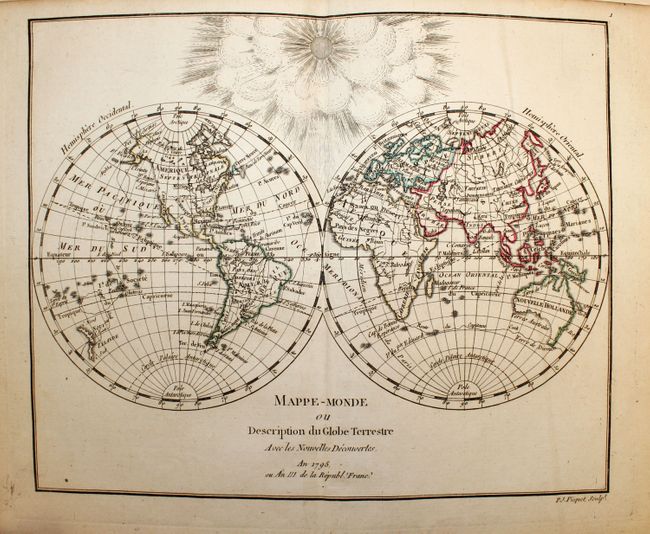
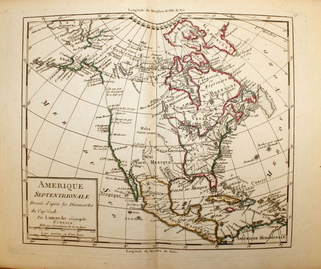
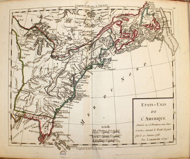
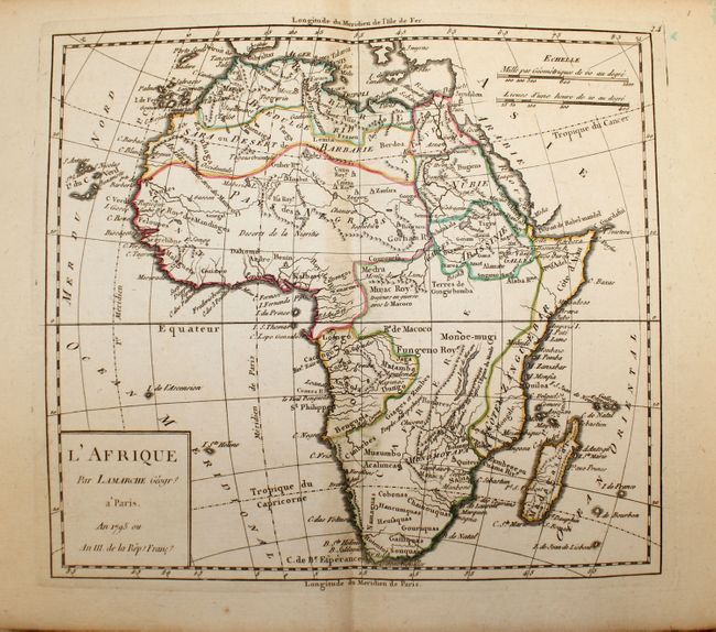
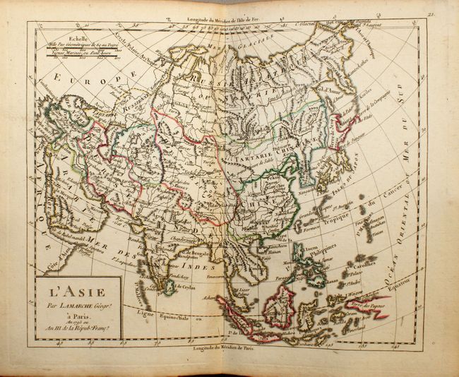
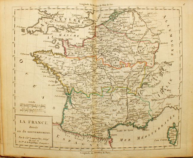
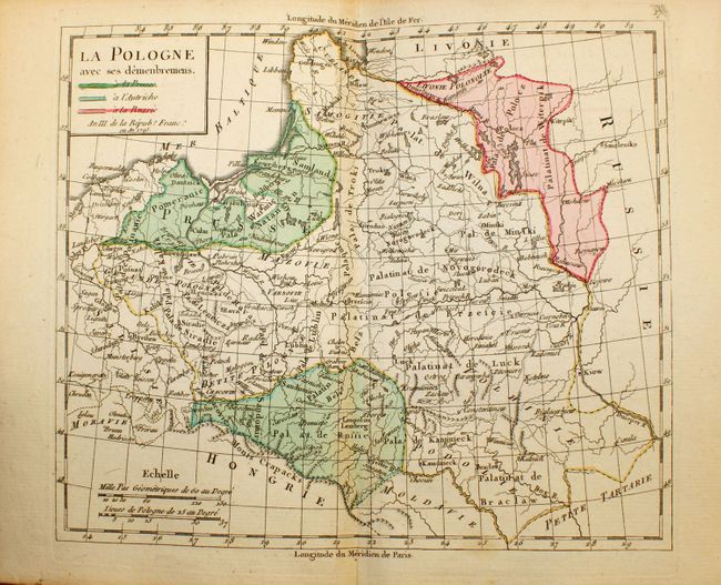
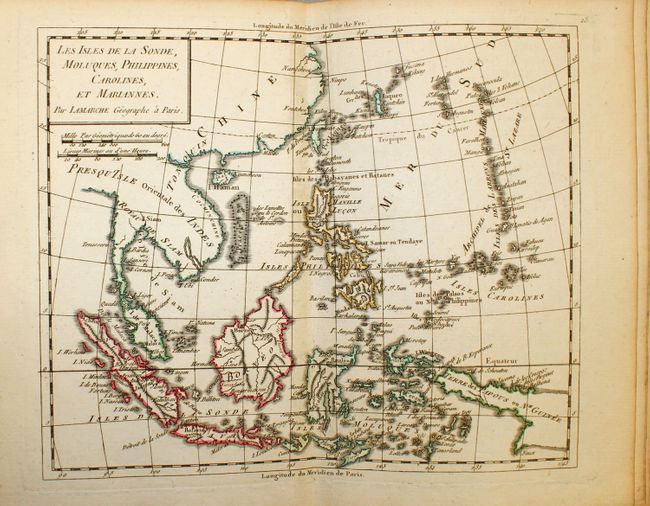
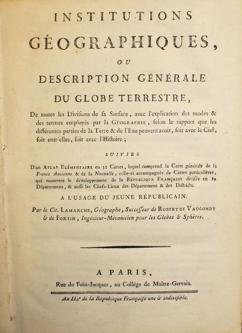
This small atlas was published during the French Revolution (An III e de la Republique Francaise une & indivisible). It includes 31 maps; World, Europe, England, Scandinavia, Russia, France (8), Germany (6), Low Countries, Switzerland, Poland, Spain & Portugal, Italy, Hungary & Balkans, Asia, Central Asia & Siberia, Southeast Asia, Africa, North Africa, Egypt, North America, South America, Colonial United States, Near East, and Palestine. The world map traces Capt. Cook’s voyages and the map of North America shows his discoveries in Alaska. Complete with 8 + 112pp and 31 maps. Quarto, quarter calf over paper boards.
References:
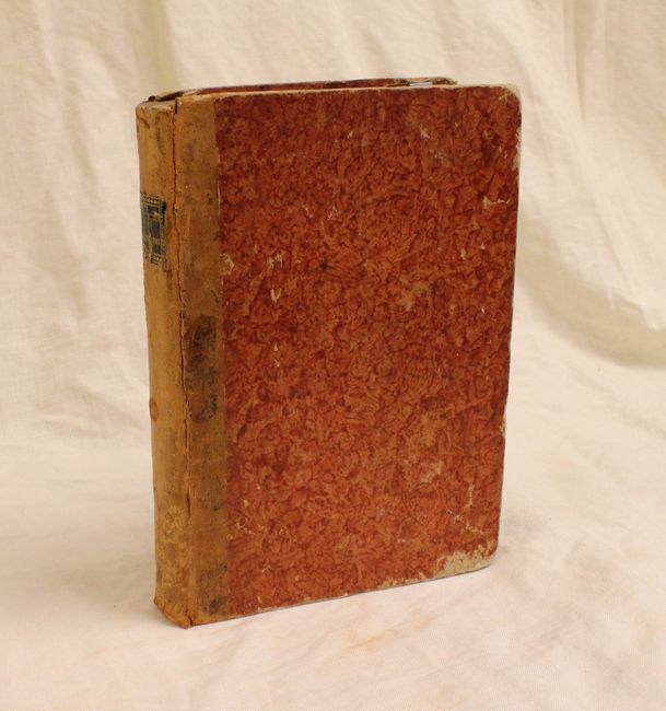
Condition: B+
Maps clean and bright with original outline color; a couple with minor centerfold separations. Text clean, endpapers with minor tape stains. Binding tight with shelf wear & spine starting to crack. Bookseller’s pastedown on inside front cover.