Subject: Tahiti
Period: 1787 (circa)
Publication:
Color: Hand Color
Size:
13.5 x 9.2 inches
34.3 x 23.4 cm
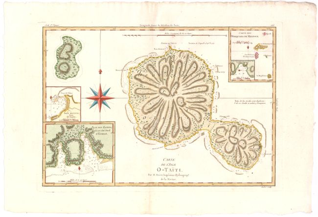
This handsome map is a remarkably accurate and early map of Tahiti. It presents the information Capt. James Cook gathered when he spent several months on the island observing the transit of Venus. The detail on the map includes topography and the depiction of reefs, anchorages and soundings. The map of Moorea (Eimeo) is less accurate. Inset maps are of harbors and anchorages on the two islands. This edition of the map, engraved by Andre, appeared in a French edition of Cook’s voyages.
References:
Condition: A+
Fine example with strong impression and wide original margins.