Catalog Archive
Auction 143, Lot 783

"A Chart of Polynesia or Groups of Islands Spread Over the North & South Pacific Oceans", Constable, Archibald

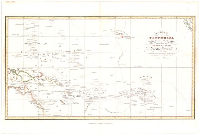
Subject: Pacific Islands

Period: 1822 (dated)

Publication:

Color: Hand Color

Size:
15.2 x 8.2 inches
38.6 x 20.8 cm
Download High Resolution Image
(or just click on image to launch the Zoom viewer)

This finely engraved map covers the islands of the South Pacific, from the northeast coast of Australia through Hawaii, with a small portion of Baja California shown in the upper right corner. The map is intensely detailed, showing names of islands and island groups, harbors, channels and straits, as well as the tracks of Captain Cook. It is typical of the precise style of early 19th century cartography with its emphasis on scientific accuracy. A few notations are included, such as "here Capt. Cook was killed Feby. 14 1779," which appears next to Hawaii. Engraved by W. H. Lizars

References:

Condition: A

Watermarked paper.

Estimate: $160 - $200

Sold for: $160

Closed on 2/13/2013

Archived