Subject: Pacific Islands
Period: 1794-1842 (circa)
Publication:
Color: Hand Color
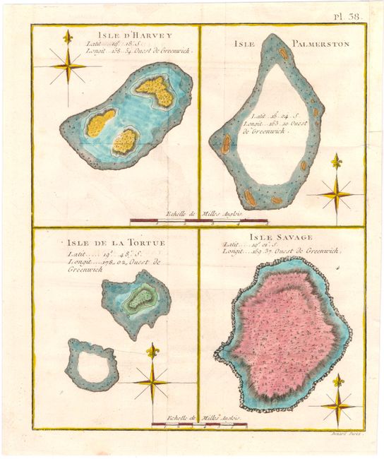
A. Isle d'Harvey [on sheet with] Isle Palmerston [and] Isle de la Tortue [and] Isle Savage, from Captain Cook's Voyages, circa 1794 (8.0 x 9.7"). This simple map shows the South Pacific islands of Manuae, Palmerston, Vatoa, and Niue, all discovered by Captain Cook from 1773-1774. Engraved by Benard. Condition: Issued folding with minor offsetting and soiling. A binding trim in the top right margin has been repaired with old paper. (B+)
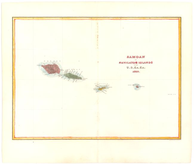
B. Samoan or Navigator Islands by the U.S. Ex. Ex., by Charles Wilkes, 1839 (11.4 x 8.3"). A nice map detailing the Samoan archipelago in Polynesia, discovered by the French explorer Louis Antoine de Bougainville, who named them the Navigator Islands. It shows the islands of Savai'i, Upolu, Tutuila, Manu'a, and Rose Atoll. Condition: A few small spots with minor toning along centerfold. (B+)
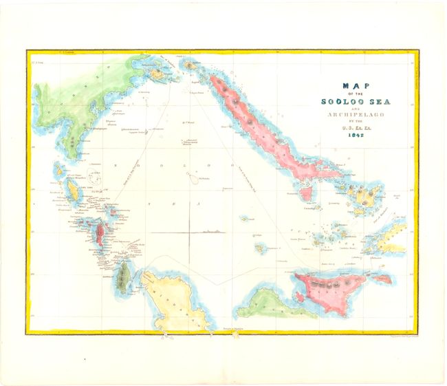
C. Map of the Sooloo Sea and Archipelago by the U.S. Ex. Ex., by Charles Wilkes, 1842 (11.3 x 8.2"). A map of the islands in the Sulu Archipelago in the southwestern Philippines. Topography and place names are shown, as well as the tracks of Vincennes, the first U.S. warship to circumnavigate the globe, and the tender Flying Fish, commanded by Wilkes to survey the area. Condition: Very minor offsetting. (B+)
References:
Condition:
See descriptions above.