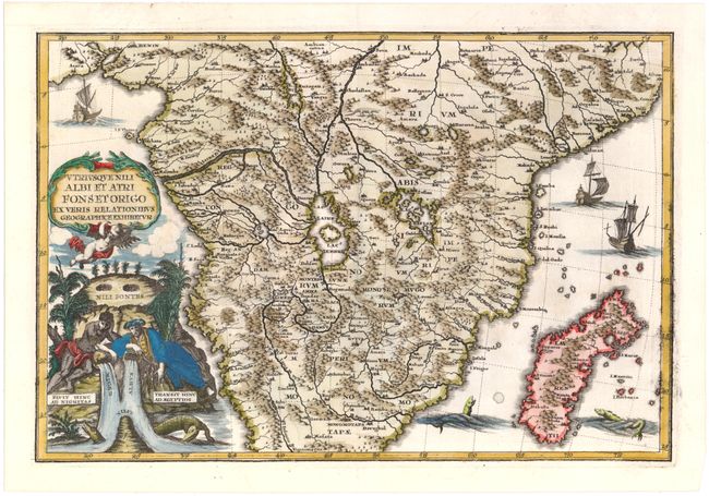
Subject: Southern Africa
Period: 1710 (circa)
Publication: Atlas Novus
Color: Hand Color
Size:
13.6 x 9.2 inches
34.5 x 23.4 cm
This decorative map of central and southern Africa and Madagascar is full of the spurious geography of the period with large lakes, rivers and mountains. The Nile is prominently featured with its twin tributaries coming out of Lake Zaire and Lake Zaflan to the east. The decorative title cartouche continues the theme with two river gods (represented by a Nigerian and an Egyptian) symbolizing the Niger and Nile Rivers, with crocodiles emerging from the waters. The map is further embellished with sailing ships and sea monsters.
References: Shirley (BL Atlases) T.SHER-1a #22.
Condition: B+
Expert repairs to several short tears and one small hole in image, with a minute amount of image in facsimile just west of Lake Zaire. There is some printer's ink residue along border at right.