Subject: Africa
Period: 1639 (dated)
Publication:
Color: Hand Color
Size:
14.2 x 10.6 inches
36.1 x 26.9 cm
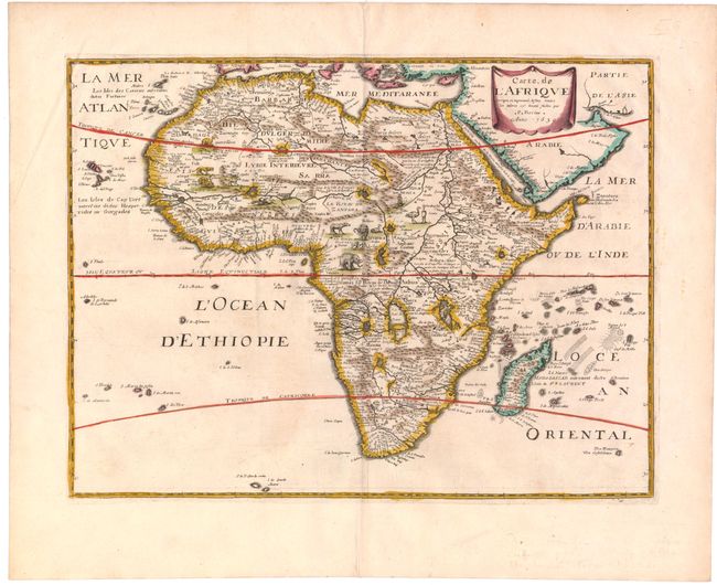
Although the title cartouche credits Petrus Bertius, this map was created by Melchoir Tavernier, and is a reduced-size version of Tavernier's map of the continent from 1627, which was derived from Hondius' influential maps from 1619 and 1623 (as was Bertius' map from 1624, hence the attribution). The geography is typical for the 17th century and is filled with spurious rivers, mountains and kingdoms. There is a considerable amount of geographic information included for a map of this size. The map is embellished with a variety of exotic animals in the interior, including elephants, ostriches, lions, and even a dragon. This map was published by Tavernier as part of a set of the world and four continents. Betz indicates that there were no known examples of the first state of this map when The Mapping of Africa was published, and this is the only example we have ever encountered.
References: Betz #68.1.
Condition: A
Watermarked paper with minor soiling and minute pinholes along centerfold, only visible when held to light.