Subject: East Indies - Papua New Guinea
Period: 1798 (circa)
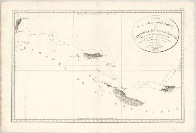
Publication: Atlas du Voyage de Bruny-Dentrecasteaux en 1792 et 1793
Color: Black & White
Size:
29.8 x 19.5 inches
75.7 x 49.5 cm
Rarely seen map showing, in great detail, the area around the Louisiade Archipelago, named for Louis XV by Louis Antoine de Bougainville. The track of Admiral Bruny-d'Entrecasteaux's ships, Recherche and Espérance, are shown along with excellent coastal and inland survey detail. In 1792-93, at the height of the French Revolution, Admiral Bruny-d'Entrecasteaux led the search for the lost expedition of La Perouse. The expedition ended in the East Indies amid open clashes between the Royalists and the Republicans in the crew after the death of d'Entrecasteaux from scurvy.
References:
Condition: B
Light soiling with some small chips and tears confined to blank margins. A small centerfold separation at center has been backed in paper and two 0.5" tears in unengraved areas of the map have been archivally repaired. There is an extraneous horizontal crease through the map.