Subject: Tokyo, Japan
Period: 1852 (circa)
Publication:
Color: Hand Color
Size:
27 x 13.2 inches
68.6 x 33.5 cm
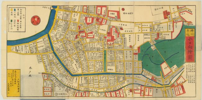
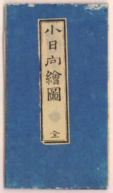
This map was reportedly created by Komatsu Masanori and published by Owariya Seishichi in "Kaei 5" or 1852. The map shows the Kobinata district in Tokyo. This colorful woodblock pocket map was printed on three sheets and joined, as issued. The map folds into stiff paper self wrappers in bright blue with a paper label on front wrapper. Travel and tourist maps are called dochuzu or "on-the-road-maps".
References:
Condition: B
Remarkable condition given its age, intended use, and fragility of construction. There are small worm holes and tracks, the larger of which have been closed on verso with Japanese tissue. The covers are in good condition with light wear and rubbing.