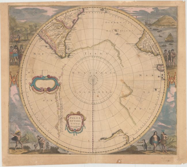
Subject: South Pole
Period: 1641 (circa)
Publication:
Color: Hand Color
Size:
19.5 x 17 inches
49.5 x 43.2 cm
This early map of the south pole is considered one of the earliest realistic maps of the Antarctic continent, which is partially delineated in a combination of coastline and strings of islands noted as first discovered by Magellan. The circular map also shows parts of South America, Africa and Madagascar with the incomplete coastline of Australia. Early Dutch explorations in the region are noted. The map is surrounded by fabulous engravings of natives and early explorers with any empty dedication cartouche. This is the first state of the map.
References: Tooley (MCC -2) #20; Tooley (Australia) #726.
Condition: B
Original color with light scattered foxing, faint text show through, and one tiny wormhole in image. There is an archivally repaired tear that enters 1.5" into image at bottom adjacent to centerfold, and a tiny hole confined to the lower blank margin.