Subject: North Pole
Period: 1740 (circa)
Publication: Modern History
Color: Black & White
Size:
10.7 x 8 inches
27.2 x 20.3 cm
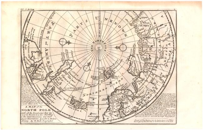
This unusual map depicts the North Pole and shows incomplete northern coastlines for North America and Greenland. Novaya Zemlya is correctly shown as an island facilitating a Northeast Passage to Asia. Above the Pole is Parts Unknown, and three compass roses complete the composition. This is the fourth state of the map, which includes a publisher's imprint, two panels of text flanking the map, and Vol. 1 p. 714 added outside the neatline, at top left. Published in London in Thomas Salmon's Modern History: or the Present State of All Nations.
References: Kershaw #410; Shirley (BL-Atlas) G.SALM-1c #19.
Condition: A
A fine impression on watermarked paper with a couple of unobtrusive spots.