Catalog Archive
Auction 143, Lot 666

"[On 2 Sheets] Terra Sancta quae et Terra Chanaan, Terra Promissionis, Terra Hebreorum, Terra Israelitarum, Iudaea, et Palestina...", Duval, Pierre
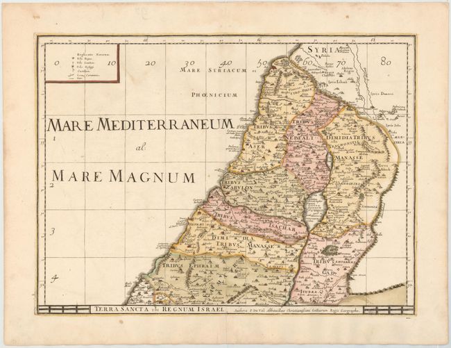
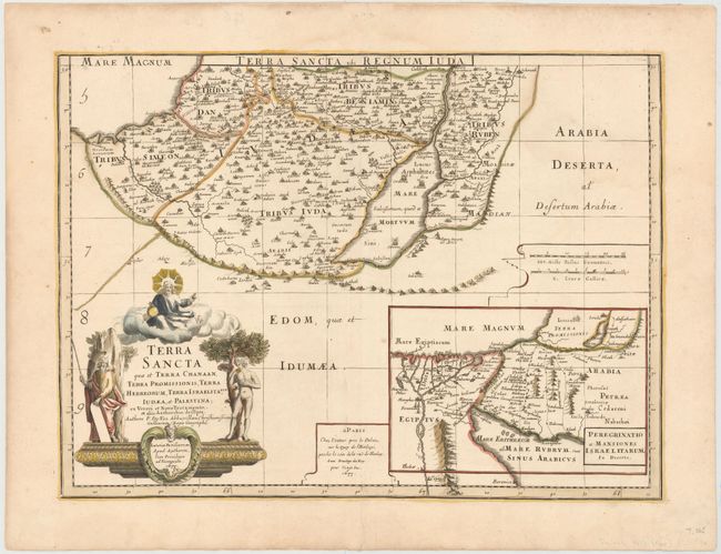
Subject: Holy Land

Period: 1677 (dated)

Publication: Cartes de Geographie les plus Nouvelles…

Color: Hand Color

Size:
20.9 x 15.4 inches
53.1 x 39.1 cm
Download High Resolution Image
(or just click on image to launch the Zoom viewer)

This large-scale map of the Holy Land is printed on two sheets and divides the region into the Twelve Tribes of Israel. It covers the region with the shoreline from Sidon to Gaza and inland to Syria and the Arabian Desert. A large inset map in the southern sheet shows the Nile Delta, Sinai and Canaan with the Wandering of the Children of Israel, titled Peregrinatio et Mansiones Israel Itarum, in Deserto. The maps are filled with fine detail with a large title cartouche gracing the southern sheet, featuring Moses, Adam eating an apple in the Garden of Eden, and God atop a cloud. Size is for each sheet; if joined the map would measure approximately 20.9 x 30.5".

References: Laor #261; Pastoureau, DUVAL II D.

Condition: B+

Watermarked paper with minor soiling.

Estimate: $500 - $600

Unsold

Closed on 2/13/2013

Archived