Catalog Archive
Auction 143, Lot 659

"Beschreibung des Heiligen Landes Canaan", Bunting, Heinrich
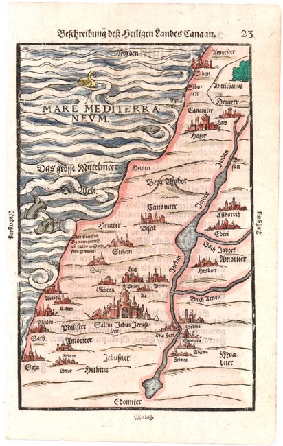
Subject: Holy Land

Period: 1600 (circa)

Publication: Itinerarium Sacrae Scripturae

Color: Hand Color

Size:
6.8 x 10.5 inches
17.3 x 26.7 cm
Download High Resolution Image
(or just click on image to launch the Zoom viewer)

Woodcut map showing the geography of the Holy Land at the time of Christ. The major cities are depicted in miniature view form with Jerusalem being the most prominent. Two sea monsters and a swan grace the Mediterranean. German text on verso.

References: Laor #140.

Condition: B+

A nice impression with a small abrasion in left blank margin just entering neatline.

Estimate: $300 - $400

Unsold

Closed on 2/13/2013

Archived