Subject: North Pole
Period: 1676 (circa)
Publication:
Color: Hand Color
Size:
9.7 x 7.2 inches
24.6 x 18.3 cm
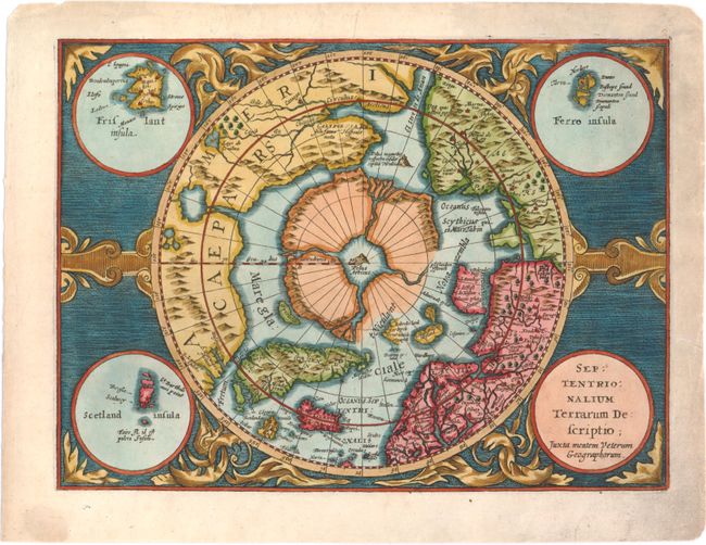
Second state of this reduced version of Mercator's famous map of the North Pole. The hemisphere is surrounded by a finely engraved design with four round insets in each corner. These contain the title, the Faeroe Isles, the Shetland Isles, and the mythical island of Frisland. The North Pole is shown according to legend as a large rock in a giant whirlpool surrounded by four islands separated by rivers. The magnetic pole is depicted as an island in the Streto de Anian. An elaborate river network and large bay is shown in the extreme northwest part of North America. This map was originally published in Johannes Cloppenburg's Atlas sive Cosmographicae from 1630-1636, and then reappeared in publications by Johann Waesberger and Henri du Sauzet. These later additions are extremely rare.
References: Burden #225; Kershaw #32.
Condition: A
Attractive color with a tiny tear in right blank margin that has been repaired with old paper.