Catalog Archive
Auction 143, Lot 596

"Tabula Europae IX", Munster, Sebastian
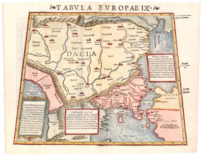
Subject: Balkans

Period: 1542 (circa)

Publication: Geographia…

Color: Hand Color

Size:
13.3 x 10.2 inches
33.8 x 25.9 cm
Download High Resolution Image
(or just click on image to launch the Zoom viewer)

Rare Ptolemaic map covering the ancient Roman provinces in the Balkans including Illyricum, Macedonia, Moesia, Thracia, Dacia, and Dalmatia. The topographical features such as mountain ranges and river systems are boldly drawn and major cities are located. The map is presented on a trapezoidal projection. Latin text on verso.

References: Mickwitz & Miekkavaara #212-11.

Condition: A

A bright, clean example with expert paper repairs along centerfold.

Estimate: $350 - $425

Sold for: $250

Closed on 2/13/2013

Archived