Catalog Archive
Auction 143, Lot 595
"A New Map of Turkey in Europe Divided into all its Provinces; with the Adjacent Countries in Europe and Asia: Drawn Chiefly from the Maps Published by the Imperial Academy of St. Petersburg", Laurie & Whittle
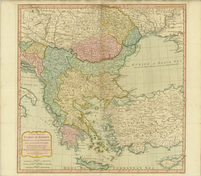
Subject: Southeastern Europe
Period: 1794 (dated)
Publication: Imperial Sheet Atlas
Color: Hand Color
Size:
23.8 x 23.7 inches
60.5 x 60.2 cm
Download High Resolution Image
(or just click on image to launch the Zoom viewer)
(or just click on image to launch the Zoom viewer)