Subject: Russia
Period: 1750 (dated)
Publication: Atlas Universel
Color: Hand Color
Size:
23.2 x 18.7 inches
58.9 x 47.5 cm
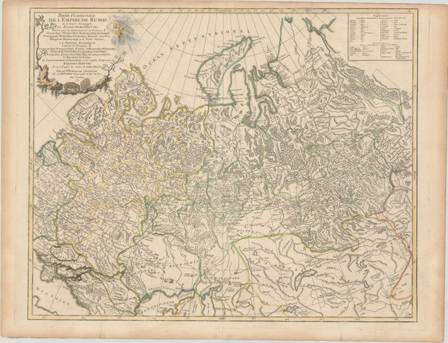
This large, detailed map covers a wide territory as described by the continuing title: "divisee par ses Gouvernemens ou Provinces de Dwinskoy, Oloneckoy, Bielozerskoy, Archangel, Nowogrod, Wolockoy, Ustinskoy, Moscow, Kiowie, Bielogorod, Woroneskoy, et la Petite Tartarie, la Partie Asiatique contient les Provinces de Berezowskoy, Mangajeiskoy, Wiatka, Solkamskoy, Pelymskoy, Utimskoy, Tobolskoy, Surgutskoy, Jenifeiskoy, Narimskoy, Kuzneckoy, Tomskoy, Krasnojarskoy &c., le Royaume de Kasan, le Gouvernement d'Astrachan et les confins du Royaume des Kalmaks Eleuths." The map shows the western part of the Russian Empire extending from Poland, and east to Irkurkoy, Ilimskoy, and the R. Tunguska, and south to include part of the Black and Caspian seas. The map provides topographical details, watershed, forests and cities. A lovely title cartouche features three wind heads and two bears, engraved by Gobin.
References: Pedley #405.
Condition: A
Original outline color with a printer's crease near table at top right and light toning along sheet edges.