Subject: Northeastern Europe
Period: 1739 (dated)
Publication:
Color: Hand Color
Size:
22.2 x 19.3 inches
56.4 x 49 cm
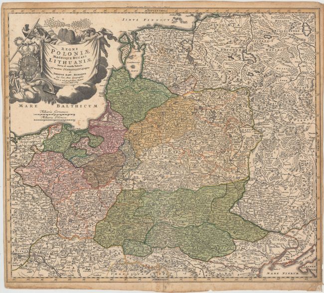
Striking example of Homann's map of Poland, Lithuania, Latvia, Estonia and a portion of Russia, extending from St. Petersburg in the north to the Black Sea in the south. The map includes a lot of topographic detail and as well as the cities of Kiev, Minsk, Warsaw and Vienna. A gorgeous allegorical cartouche fills the Baltic Sea and features Ares, god of war, holding both a spear and a laurel wreath, the Polish-Lithuanian coat of arms under Wettin dynasty, and beehives symbolizing industry.
References:
Condition: B
Light toning primarily in borders and along sheet edges, scattered foxing, and an archivally repaired tear in bottom margin that extends 1" into map. The left and right margins have been trimmed close to neatline, and there is a tiny tear in neatline at bottom right. There is non-archival tape on the edges of the sheet on verso.