Subject: Schlei River, Germany
Period: 1662 (published)
Publication: Atlas Maior
Color: Hand Color
Size:
25.3 x 16.6 inches
64.3 x 42.2 cm
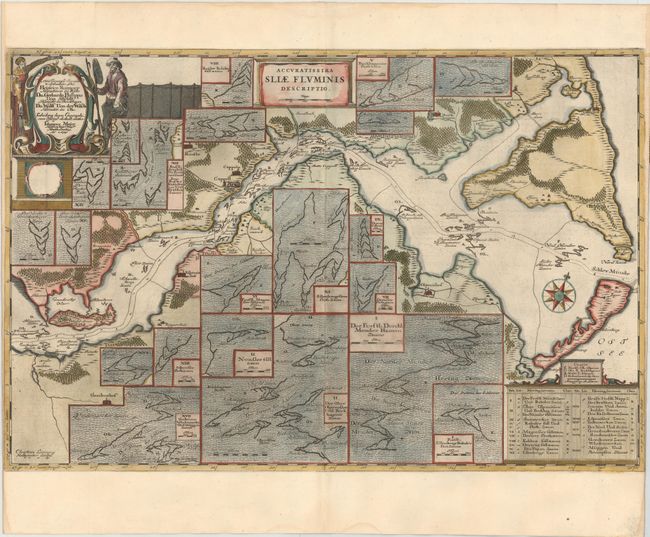
This rare map follows a portion of the Schlei River from its inlet on the Baltic Sea to Arnis, Germany, in Schleswig-Holstein. The map illustrates depth soundings and currents, in addition to good detail along the river banks of towns, roads, and the topography of the land. However the most intriguing information on the map concerns the depiction of the numerous fishing weirs located throughout the inlet and river, used to trap herring. Enlarged charts of the fishing weirs are shown in about 20 insets, which include the names of those who own fishing rights in the area. Cartographic evidence of fishing rights are extremely rare, making this chart a unique historical document. The map was originally created by surveyor and cartographer Johannes Mejer in 1649 for an atlas on Schleswig Holstein. The plates were later sold to the Blaeu family, who republished them in 1662. Engraved by Christian Lorensen Rodtgiesser. Dutch text on verso.
References:
Condition: A
On watermarked paper, trimmed close to neatline at sides, as issued. There are small damp stains in blank margins, not affecting image.