Catalog Archive
Auction 143, Lot 559

"Fimbriae, vulgo Femeren Delineatio Geometrica", Blaeu, (Family)

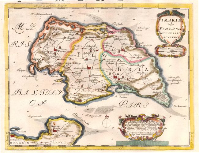
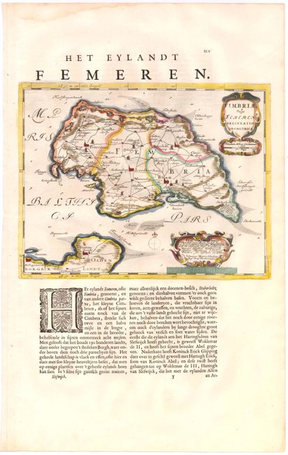
Subject: Fehmarn, Germany

Period: 1662 (circa)

Publication: Atlas Maior

Color: Hand Color

Size:
11.8 x 9.2 inches
30 x 23.4 cm
Download High Resolution Image
(or just click on image to launch the Zoom viewer)

A handsome map of the island of Fehmarn, depicting towns, roads, and political divisions. The map was originally created by surveyor and cartographer Johannes Mejer in 1649 for an atlas on Schleswig Holstein. The plates were later sold to the Blaeu family, who republished them in 1662. The map is adorned with two strapwork cartouches, one of which credits Mejer. On a sheet of Dutch text (13.2 x 21.0").

References:

Condition: A

Bright, clean hand-laid paper with a small rust stain next to Grossenbrode, and a damp stain in top blank margin, far from map.

Estimate: $110 - $140

Sold for: $110

Closed on 2/13/2013

Archived