Catalog Archive
Auction 143, Lot 547

"Sylva Danica vulgo Daenischen Walde", Blaeu, (Family)

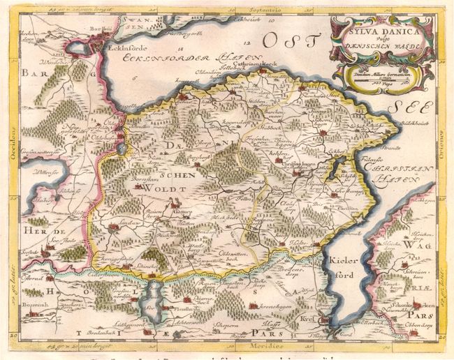
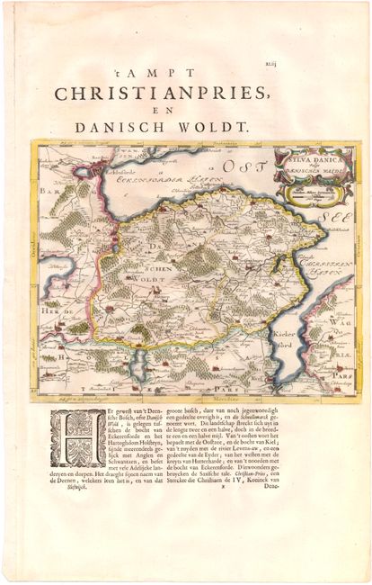
Subject: Northern Germany

Period: 1662 (circa)

Publication: Atlas Maior

Color: Hand Color

Size:
12 x 9.5 inches
30.5 x 24.1 cm
Download High Resolution Image
(or just click on image to launch the Zoom viewer)

A handsome map of the eastern portion of Schleswig-Holstein, between Eckernforde and Kiel. There is good detail of towns, roads, and forested areas. Adorned with a strapwork title cartouche incorporating the distance scale. The map was originally created by surveyor and cartographer Johannes Mejer in 1649 for an atlas on Schleswig Holstein. The plates were later sold to the Blaeu family, who republished them in 1662. On a sheet of Dutch text (13.2 x 21.0").

References:

Condition: A

Watermarked paper with a short tear in left blank margin and a minor damp stain in top blank margin, neither affecting map.

Estimate: $110 - $140

Sold for: $140

Closed on 2/13/2013

Archived