Catalog Archive
Auction 143, Lot 545
"[Lot or 2] Cercles de Westphalie, Haut et Bas Rhin… [and] L'Alemagne Divisee en Tous ses Cercles avec les Pays qui en dependent…", Brion de la Tour/Desnos
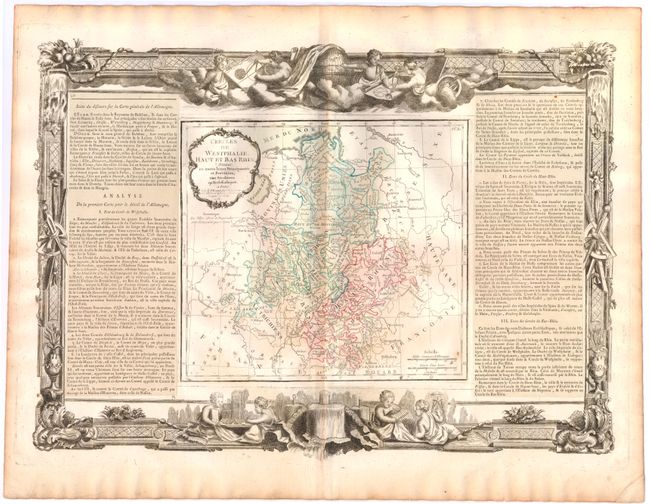
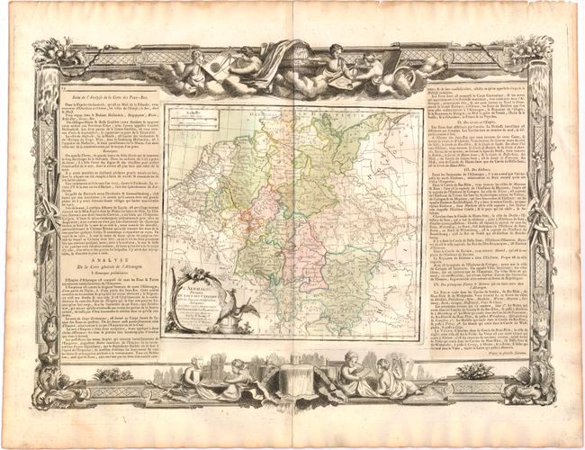
Subject: Germany
Period: 1766 (dated)
Publication: Atlas General et Elementaire
Color: Hand Color
Size:
20.5 x 14.8 inches
52.1 x 37.6 cm
Download High Resolution Image
(or just click on image to launch the Zoom viewer)
(or just click on image to launch the Zoom viewer)