Subject: Northern France
Period: 1709 (dated)
Publication:
Color: Hand Color
Size:
25.4 x 18.6 inches
64.5 x 47.2 cm
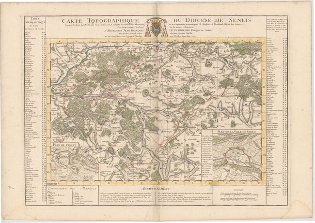
Beautifully engraved map of the region just north of Paris includes le Plessis Belleville, Dammartin, Lusarche, Creil, and Crespy en Valois. Detailed to show many villages, towns, roads and even individual trees to indicate forests. With two insets: Plan de Crespy and Plan de la Ville de Senlis. Surrounded by extensive tables keyed to map.
References:
Condition: B
Watermarked paper with light soiling and an extraneous crease along centerfold, some scattered stains, and a tear entering 2" into map image at bottom that has been archivally repaired. There are two damp stains in bottom left and right blank margins and a short centerfold separation in bottom blank margin.